Snowfields and glacierets in Val Forcone.
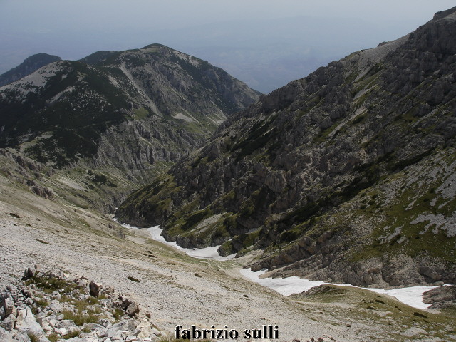
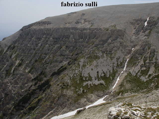
The snowfields of Val Forcone are situated in the massif of the Majella, in the high part of the valley that divides Mount Acquaviva (2737 m) from the Murelle peak (2596 m.), known as Val Forcone.
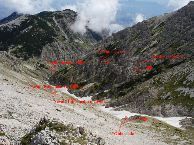
The perpetual snow plaques are at least four, and if their number had increased in the last years, the disastrous 2007 has reduced it.
They are well boxed in the valley, and their permanence could have transformed some snowfields into glacierets.
The height of the snowfields goes from about 1800 to 2200 m., while its supply comes mostly from avalanches, caused by the snow that falls from the sides of Mt. Acquaviva and in part by “draught” since they are positioned downwind of the north east wind.
The largest snowfield, called “the glacier” by the shepherds, situated at about 2150 m., is the highest one and it surely receives good build-up from the canal that cuts across the sides of Mt. Acquaviva, which drops its snow directly on it.
Fabrizio Sulli
To visit the snowfields and glacierets described above you can follow the trail that from Mt. Focalone takes you to the west ridge of the Murelle peak (5C trail on the CAI map), and then leave it to go down to Val Forcone when you reach the beginning of the valley.
Or you can go to Cantagufo di Palombaro, the second mountain shelter of Monte D’Ugni, walking on a long dirt road that will take you there. From here you can climb up to the Murelle peak and admire the snowflieds and Val Forcone from above.
Anyhow, Val Forcone is crossed by the 7B trail on the CAI map, that from Callarelli connects you to the 5C trail for the Murelle. In this case you must leave from Fara San Martino.
Fabrizio Sulli
Translation by Giuseppe Petricca